
by Pavutu · Windows
Pavutu ParselHesap — from source document to checked parcel calculations
Compare coordinates with their source, calculate the area and bring your work together in a traceable PDF calculation report.
Availability
Being prepared for Windows; not yet available from the Microsoft Store.
 (opens the larger image)
Product video (Turkish)
Check coordinates before calculating
Open TXT, CSV, TSV and XLSX tables, text-based or scanned PDFs, and PNG/JPEG images. Review the extracted table beside the source, map the columns and approve the values before transferring them into a calculation.
Screenshots show the real Windows application in Turkish, using synthetic examples. The application interface is Turkish.
-
Map split coordinate values
When integer and decimal parts occupy separate cells, explicitly choose the columns that belong together. Check the raw values and their locations in the source.
 (opens the larger image)
Map split coordinate values -
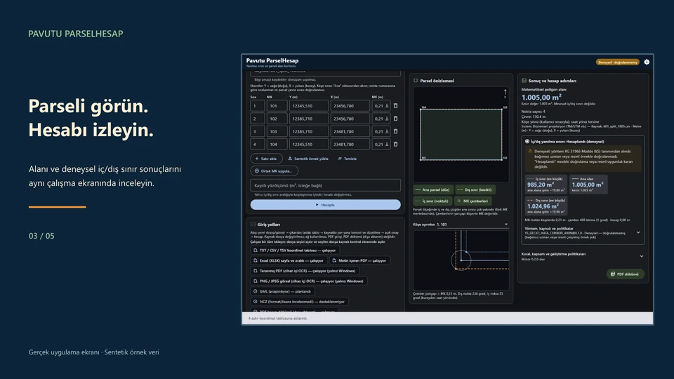
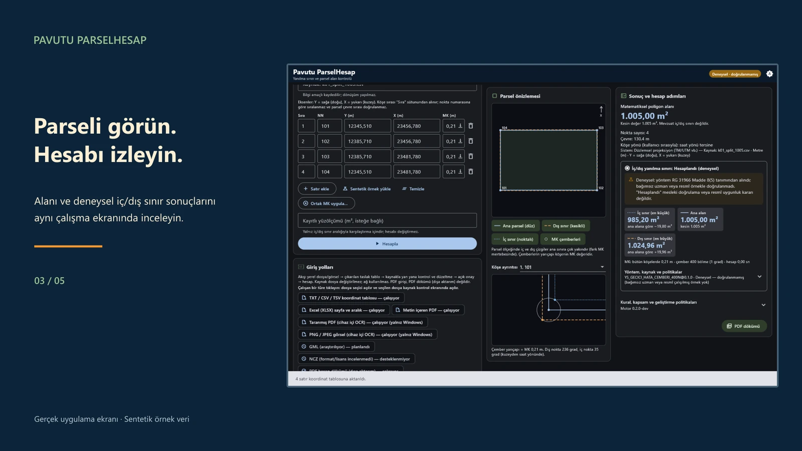
Review the area and drawing
View the mathematical parcel area and polygon drawing. With the required inputs, inspect experimental inner and outer area bounds.
 (opens the larger image)
Review the area and drawing -
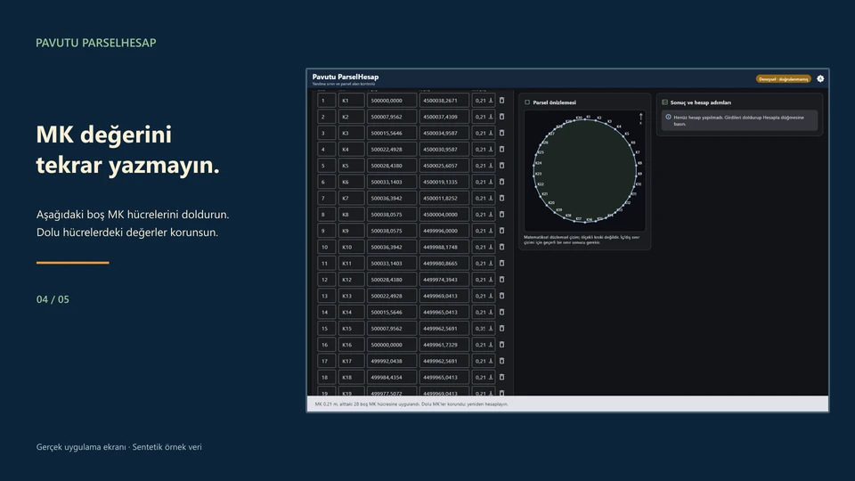
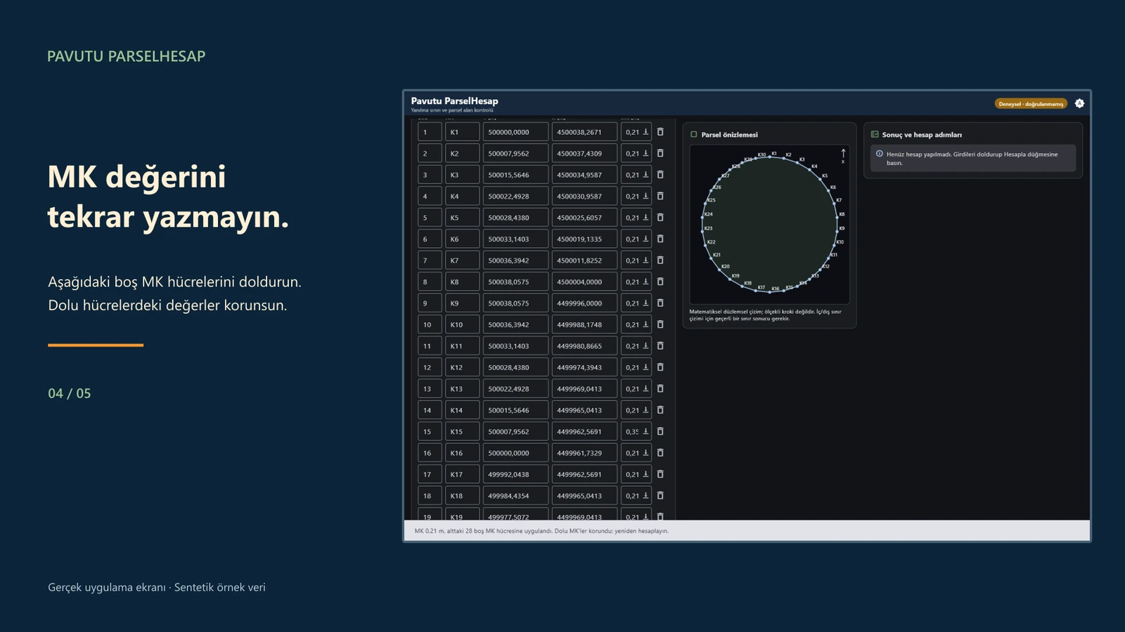
Apply positional accuracy values explicitly
Enter a shared point positional accuracy value (MK), or copy one row’s value into the empty MK cells below it. Existing values are preserved.
 (opens the larger image)
Apply positional accuracy values explicitly -
Prepare a PDF calculation report
Review inputs, source traces, method and results in one report. Preview it before saving a separate PDF file.
 (opens the larger image)
Prepare a PDF calculation report


Scope and limits
This is an experimental engineering calculation assistant. Compare OCR results and all coordinates with the source. The inner and outer bounds method has not been validated against independent professional reference cases. The application and PDF report do not replace professional review or official approval.
The numeric calculation view shows area tolerance steps and the difference from a registered area. Results depend on the selected calculation method and the values you provide.
The workspace supports tables of up to 200 points. You specify the vertex order, coordinate system and unit; the application does not transform coordinates. NCZ, GML and DXF input, automatic access to government systems and persistent project saving are outside this version’s scope.
Platform, privacy and support
Work with local files
Documents are read and calculations run on your computer. The application does not upload them to Pavutu or an online OCR service. Image recognition requires Windows OCR and an appropriate OCR language feature.
Frequently asked questions
Does the app perform an official parcel lookup?
No. It uses local files or values you enter. It does not connect to government portals or issue official compliance decisions.
What does the PDF report contain?
Calculation inputs, source information, the method used and results. It is a working record, not an official document or electronic signature.
Is there a free and PRO split?
Every feature is available in the free version. The free version gives you 3 jobs each month (renewed on the 1st) plus a one-time bonus of 2 jobs on first use. A job is counted the first time you calculate an area from a source in a given month; corrections, recalculations and PDF reports for the same source don’t use another job. PRO is a one-time purchase through the Microsoft Store that removes the monthly limit; you can see the current price in the Microsoft Store.
Which language and platform does it support?
It is a Windows desktop application with a Turkish interface. This delivery does not include Android or Mac versions.